Geology and old mine workings
What Lies Beneath the Land?
Holmans Test Mine exists within a historically mined Cornish granite terrain. Understanding what is beneath the surface is a precondition for interpreting anything observed on it.
Geological figures
The published record of what lies beneath
Extracts from British Geological Survey material and from the geology and hydrogeology report, together with an image of granite excavation at the site.
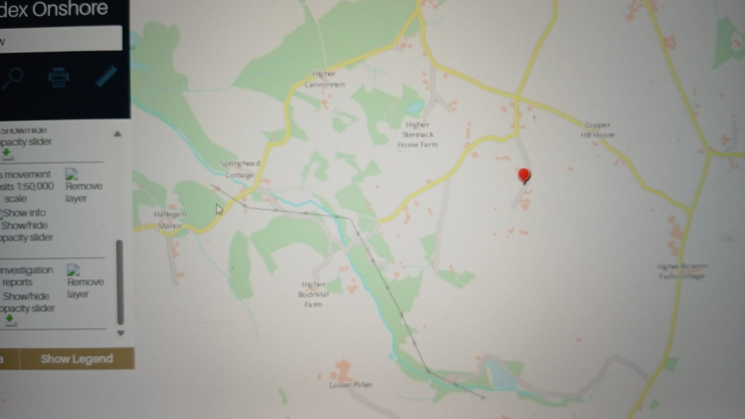
BGS GeoIndex Onshore — Carwynnen sheet
British Geological Survey GeoIndex Onshore viewer centred on the Carwynnen / Higher Bodrivial area, with mass-movement deposits and site investigation report layers enabled. The red pin marks the reference location used in the report.
What this does and does not show: A black cross-marked line runs north-west to south-east across this extract. It is a mapped linear geological feature — a reported weak fracture / structural lineament corridor. It is now shown as an optional layer on the environmental map. Its position on this website is traced from the screen capture and is indicative only.
Source: BGS GeoIndex screen capture, reproduced in the BGS geology & hydrogeology report
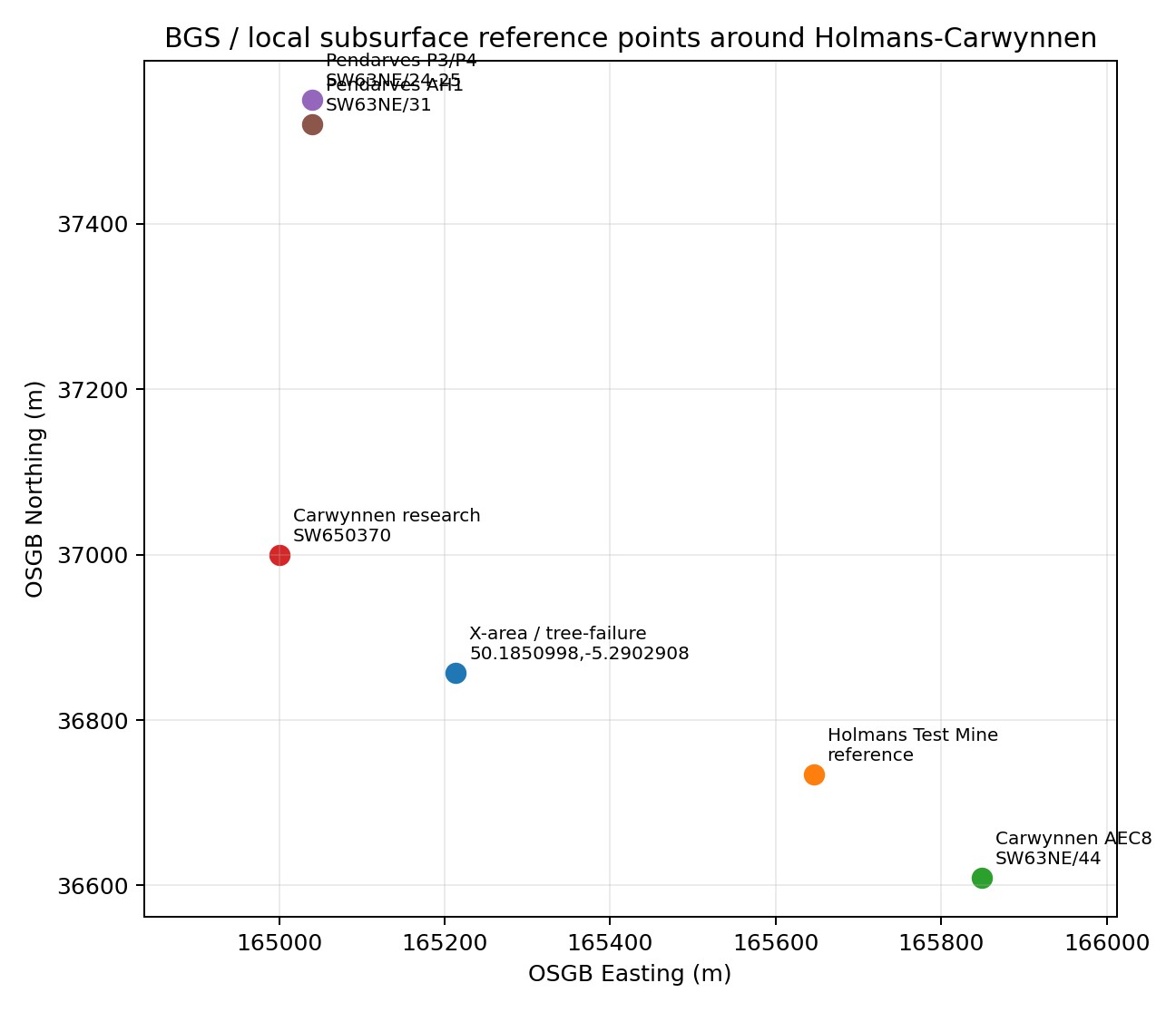
Local subsurface reference points (OSGB grid)
Plot of BGS and local subsurface reference points around Holmans–Carwynnen on the OSGB national grid, including the X-area tree-failure coordinate 50.1850998, -5.2902908 and the Holmans Test Mine reference point.
Source: BGS geology & hydrogeology report, figure
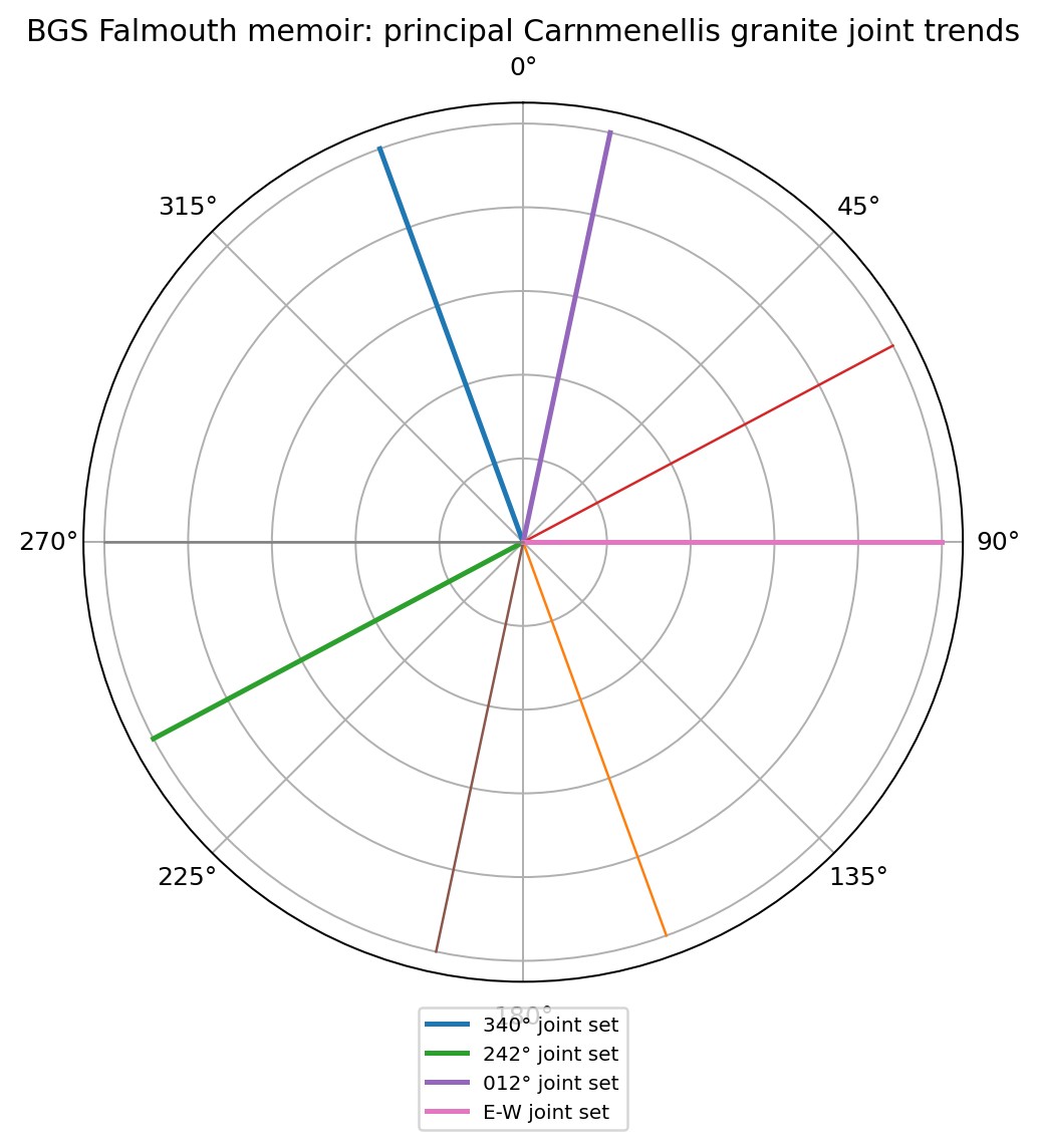
Principal Carnmenellis granite joint trends
Rose diagram of the principal joint sets recorded in the Carnmenellis granite: approximately 340°, 242°, 012° and an east–west set.
What this does and does not show: Jointing controls where granite can transmit water and where energy can travel. These orientations are the reason the investigation asks whether effects are aligned with structure rather than randomly distributed.
Source: BGS Falmouth memoir, summarised in the geology & hydrogeology report
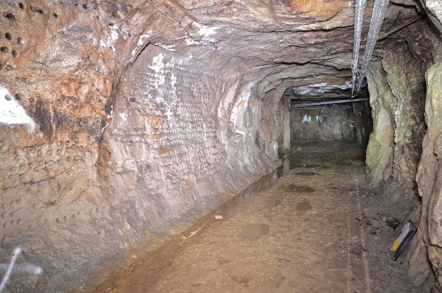
Underground tunnel, granite host rock
Photograph of an underground excavation in granite with a graded floor and a side chamber opening. The operator states excavations are predominantly in igneous intrusive granite with some minor mineral veins.
Source: Operator-published material reproduced in the master dossier

The Camborne–Troon–Carwynnen area sits on and around the Carnmenellis granite and its surrounding metamorphic aureole. It was one of the most intensively worked hard-rock mining districts in the world.
Three centuries of mining left a subsurface that is, in engineering terms, a partially documented three-dimensional structure: shafts, adits, stopes, drainage levels and backfill, overlain by the natural pattern of faults, joints and lodes.
Modern maps record only part of it. Many workings pre-date systematic record keeping, plans have been lost, and recorded positions are frequently approximate. This is not a criticism of anyone; it is the normal condition of an old mining district and it is precisely why professional investigation is required.
Subsurface features
What the ground contains
Granite
The host rock of the district: strong, low matrix permeability, but crossed by structural discontinuities that control both water and stability.
Faults
Large-scale displacements that can act as major groundwater conduits or barriers, and which influence where mineralisation occurs.
Fractures and joints
Smaller-scale openings that collectively provide most of the rock's effective permeability.
Mineral lodes
The mineralised veins that were the target of mining. They are also preferential pathways for water and for oxidation reactions.
Shafts
Vertical or inclined access routes, some capped, some backfilled, some poorly recorded. Capping can fail decades after installation.
Adits
Near-horizontal tunnels driven for access and, critically, for drainage. Adits still drain large volumes of water across Cornwall.
Stopes
The voids left where ore was extracted, sometimes extending close to the surface.
Backfilled workings
Workings refilled with waste rock. Backfill can settle, wash out or consolidate over long periods.
Shallow workings
Near-surface exploitation, often the earliest and least documented, and the most relevant to surface stability.
Groundwater
The water table in a mined terrain is not a smooth surface; it is influenced by the drainage network the miners created.
Historic mine drainage
Deliberate engineering to keep workings dry. When it decays or is blocked, water levels and flow paths change.
Schematic
A mined granite terrain in section
Simplified conceptual section. Not to scale, not site-specific, and not a substitute for mine plans or a geotechnical model.
A point that must not be lost
Why old mine workings matter
Ground instability can arise from historic workings independently of any modern activity. Crown holes form over shallow workings, shaft caps fail, backfill washes out and ground settles — in Cornwall these things happen without any external trigger at all, sometimes centuries after the mining ceased.
This cuts both ways, and honest investigation must accept both directions. It means a ground failure near a facility is not evidence that the facility caused it. It also means the presence of old workings does not, by itself, exclude a contributory modern factor.
The scientific investigation therefore needs to establish whether reported ground changes align with the pattern that would be expected from each candidate cause.
Test the alignment against
- Recorded positions of old workings
- Mapped faults and fractures
- Modelled and observed water pathways
- Historic shaft positions and cap records
- Rainfall records around each incident
- Groundwater level changes
- Modern vibration records, where they exist
Where a reported change aligns with several candidate causes, weighting between them is a matter for qualified specialists, not for this website.
Evidence status
Geology: where this stands
Historic mining terrain
The district contains extensive recorded historic mine workings. Established by public geological and mining records, including BGS material.
Records are incomplete
Mine plan coverage of early and shallow workings is known to be partial across Cornwall. Established by the general state of the archive record.
Subsurface beneath the X-Area
What lies immediately beneath the investigation area is not established. Obtaining archive mine plans and BGS borehole records is a priority for the project.