Propagation
How Can Underground Effects Travel?
A circle drawn on a map is not a scientific statement. In fractured, historically mined ground, what matters is not how far away something is but what connects it.
Pathway imagery
Structure, rock and route
Jointing and mapped structure determine where energy and water can travel. These images show the physical setting the propagation questions relate to.
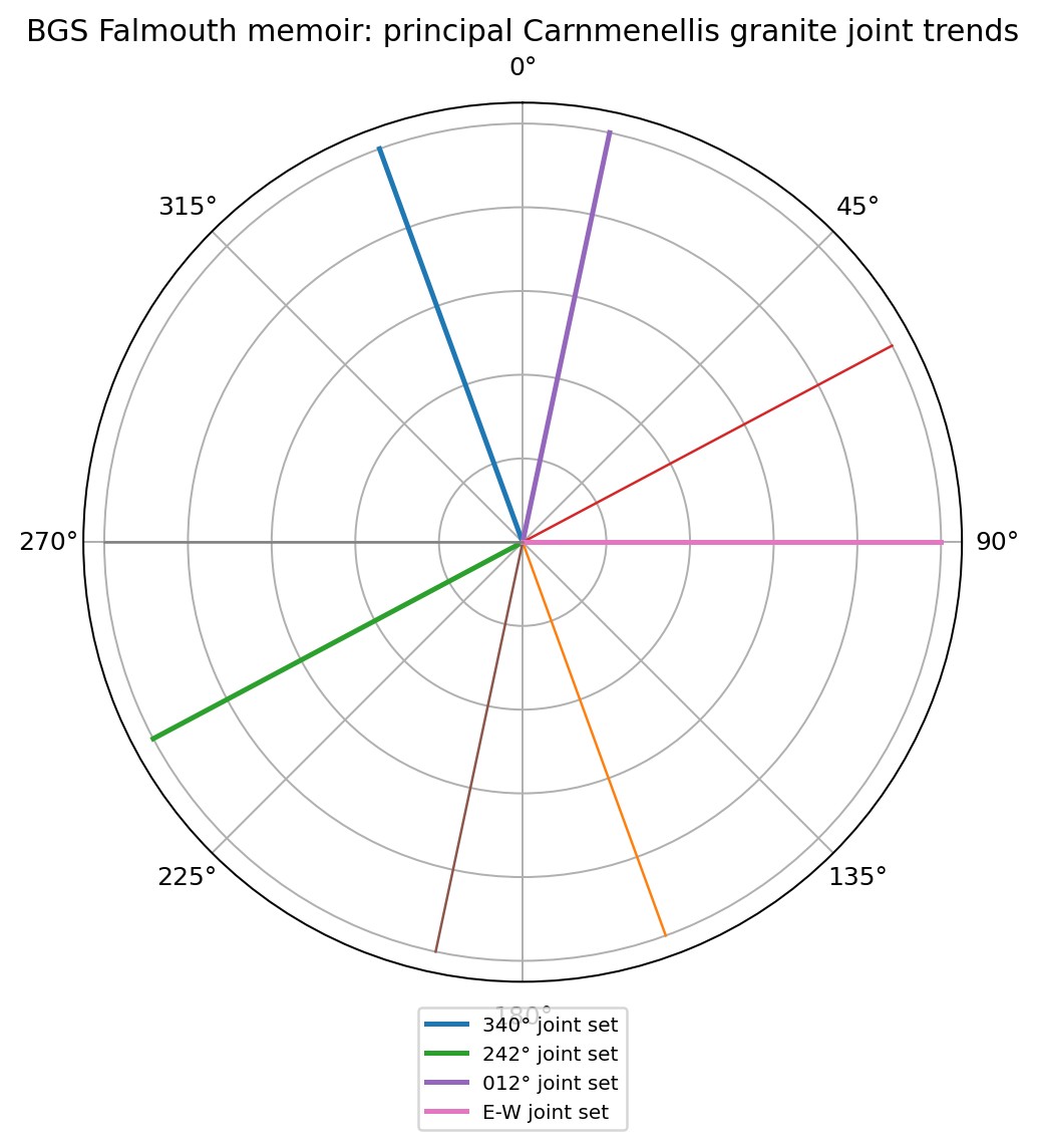
Principal Carnmenellis granite joint trends
Rose diagram of the principal joint sets recorded in the Carnmenellis granite: approximately 340°, 242°, 012° and an east–west set.
What this does and does not show: Jointing controls where granite can transmit water and where energy can travel. These orientations are the reason the investigation asks whether effects are aligned with structure rather than randomly distributed.
Source: BGS Falmouth memoir, summarised in the geology & hydrogeology report
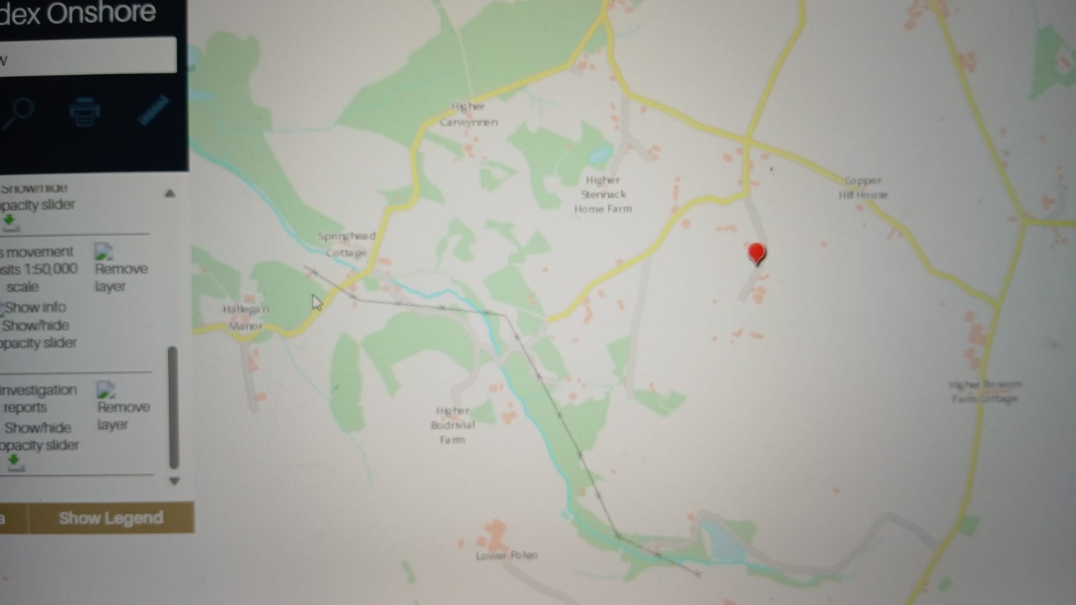
BGS GeoIndex Onshore — Carwynnen sheet
British Geological Survey GeoIndex Onshore viewer centred on the Carwynnen / Higher Bodrivial area, with mass-movement deposits and site investigation report layers enabled. The red pin marks the reference location used in the report.
What this does and does not show: A black cross-marked line runs north-west to south-east across this extract. It is a mapped linear geological feature — a reported weak fracture / structural lineament corridor. It is now shown as an optional layer on the environmental map. Its position on this website is traced from the screen capture and is indicative only.
Source: BGS GeoIndex screen capture, reproduced in the BGS geology & hydrogeology report
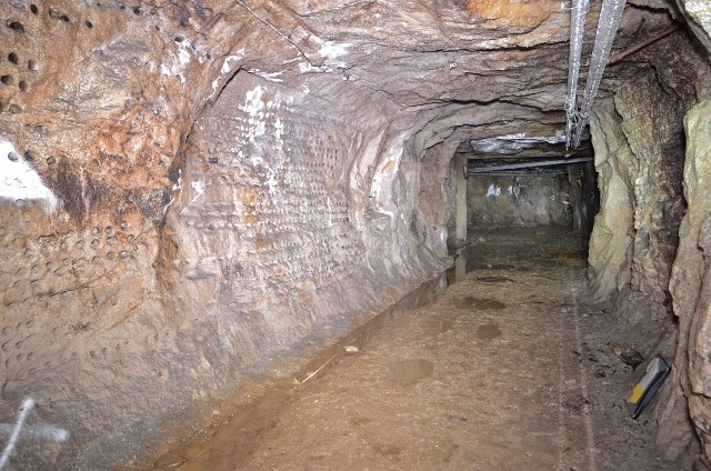
Underground tunnel, granite host rock
Photograph of an underground excavation in granite with a graded floor and a side chamber opening. The operator states excavations are predominantly in igneous intrusive granite with some minor mineral veins.
Source: Operator-published material reproduced in the master dossier
Controls
What actually governs propagation
- Explosive quantity
- Explosive composition
- Degree of confinement
- Depth below surface
- Test-chamber construction
- Rock mass quality
- Faults
- Fracture density and orientation
- Historic workings
- Voids and backfill
- Groundwater conditions
- Tunnel geometry
Several of these are known only to the operator and its regulators. Until they are disclosed, no one outside the site can model this properly — which is itself one of the central findings of this project.
Four pathways
Each must be examined separately
They behave differently, they are measured differently, and one can be absent while another is present.
Vibration pathway
Working hypothesisGround-borne vibration attenuates with distance, but not evenly. Fractures and voids reflect, refract and channel energy, so two properties at the same distance can experience materially different levels.
How it is measured · Measured by seismographs at receptor locations, reported as peak particle velocity against BS 7385.
Mine-working pathway
Working hypothesisConnected tunnels, shafts and stopes form an engineered network. Where such a network exists, effects can be transmitted along it in directions that surface geography would not predict.
How it is measured · Established by mine plan analysis, survey and, where necessary, direct inspection.
Hydraulic pathway
Working hypothesisWater moves through interconnected workings and fractures, carrying dissolved and suspended material. This is the pathway most relevant to any contamination question.
How it is measured · Established by water-level monitoring, hydrochemistry and tracer testing.
Ventilation pathway
Working hypothesisForced ventilation exists to move air out of underground workings. Where old openings connect to the same rock mass, gases can also move through routes that were never designed for them.
How it is measured · Established by air monitoring at external receptors, timed against operational events and wind data.
Zones
Monitoring and investigation zones
These are organising tools for where measurement should be prioritised. They carry no implication that any effect occurs within them.
250 m
Immediate zone. Highest priority for vibration monitoring and ground inspection.
500 m
Near zone. Includes the X-Area investigation coordinate.
1 km
Local zone. Water features and nearest dwellings.
2 km
District zone. Covers Carwynnen and part of Troon.
5 km
Catchment zone. Relevant to hydrogeology and to control-site selection.
As real measured data becomes available — vibration records, water results, ground survey — these zones will be replaced by evidence. That is the intention: the rings are scaffolding, to be dismantled once the building exists.