Ground stability
Sinkholes, Subsidence and Ground Movement
Ground movement in an old mining district is common, consequential, and frequently misattributed. This section exists to record observations well enough that cause can actually be determined.
Ground imagery
Depressions, hollows and disturbed ground
Reported ground features photographed alongside tree failures. Nothing here has been levelled, surveyed or confirmed as subsidence.
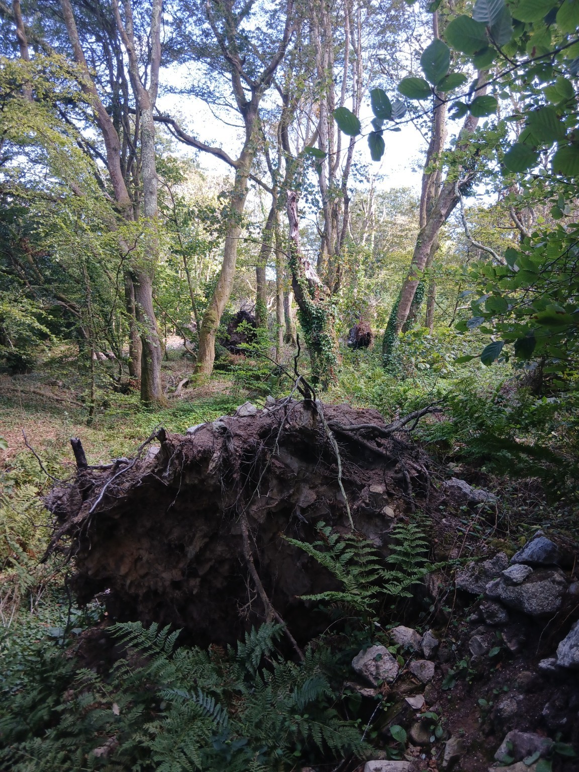
Root plate and depression, second location
Upturned root plate with a hollow behind it. An environmental geologist is reported to consider part of this ground sunken or depressed; this has not been surveyed.
Source: X-area tree-failure photographic schedule (Appendix B)
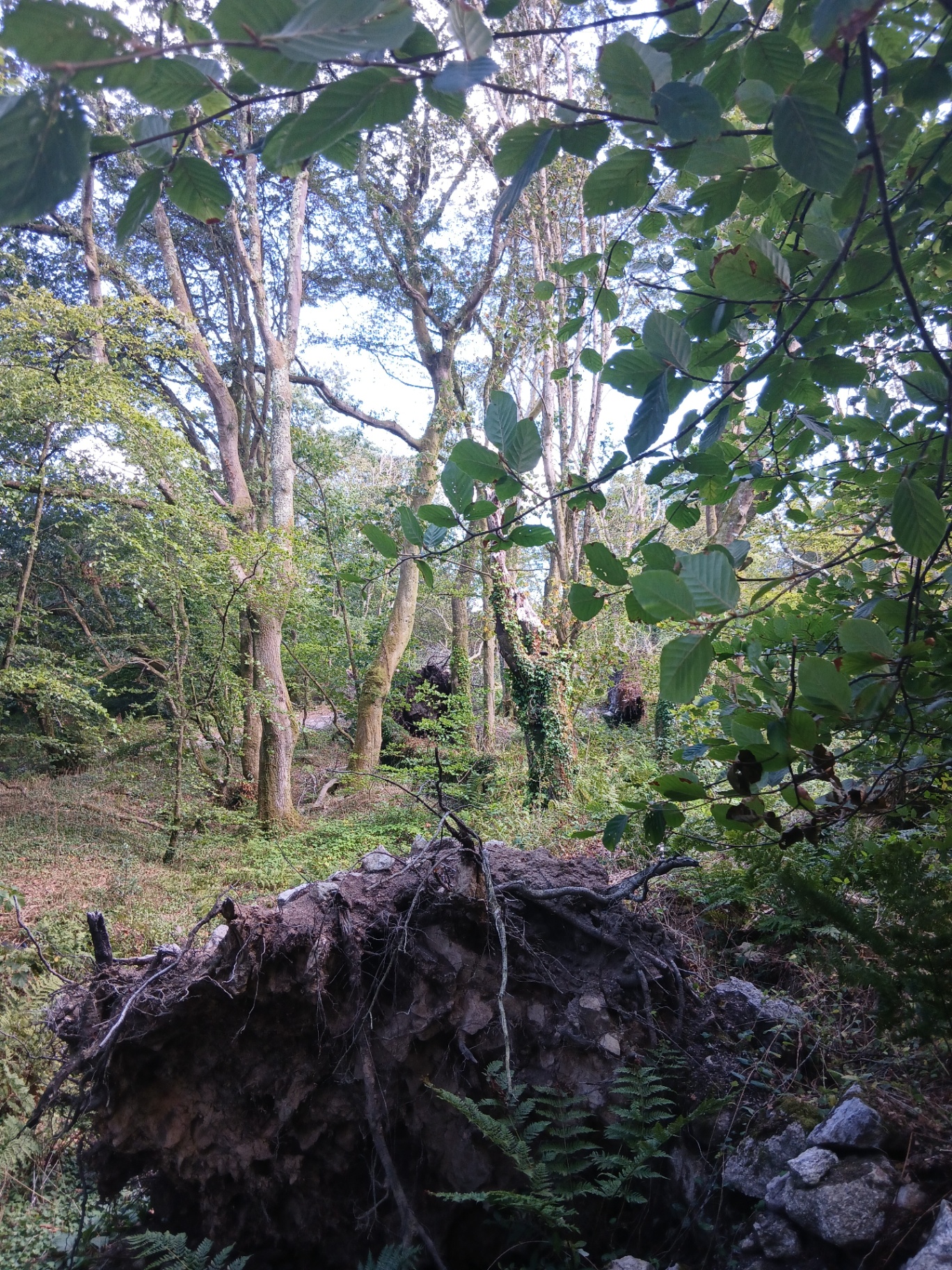
Field survey — root plate and hollow (20 Aug 2026)
Large upturned root plate holding soil and stone, with an open hollow behind it and further failures visible in the background.
Source: Community field photograph, X-area, 20 August 2026
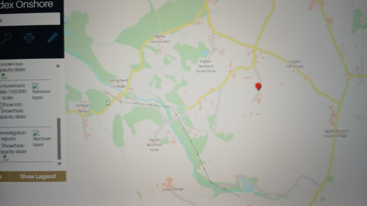
BGS GeoIndex Onshore — Carwynnen sheet
British Geological Survey GeoIndex Onshore viewer centred on the Carwynnen / Higher Bodrivial area, with mass-movement deposits and site investigation report layers enabled. The red pin marks the reference location used in the report.
What this does and does not show: A black cross-marked line runs north-west to south-east across this extract. It is a mapped linear geological feature — a reported weak fracture / structural lineament corridor. It is now shown as an optional layer on the environmental map. Its position on this website is traced from the screen capture and is indicative only.
Source: BGS GeoIndex screen capture, reproduced in the BGS geology & hydrogeology report
Incident recording
What is collected for every ground-collapse observation
All ground-collapse observations can be plotted on the environmental map. The fields below are collected for each one, because they are the fields a geotechnical engineer or the local authority would need.
| Field | Why it matters |
|---|---|
| Date discoveredEstablishes the earliest point the feature is known to have existed — not necessarily when it formed. | Establishes the earliest point the feature is known to have existed — not necessarily when it formed. |
| CoordinatesAllows correlation against mapped workings, faults and water features. | Allows correlation against mapped workings, faults and water features. |
| DimensionsDiameter, depth and shape at first observation, in stated units. | Diameter, depth and shape at first observation, in stated units. |
| PhotographsWith original metadata preserved, and a scale object where possible. | With original metadata preserved, and a scale object where possible. |
| Whether it changed over timeProgressive enlargement points to an ongoing process rather than a single event. | Progressive enlargement points to an ongoing process rather than a single event. |
| Rainfall around the incidentIntense or prolonged rainfall is one of the most common triggers for collapse. | Intense or prolonged rainfall is one of the most common triggers for collapse. |
| Nearest mine featureDistance and direction to the nearest recorded shaft, adit or working. | Distance and direction to the nearest recorded shaft, adit or working. |
| Nearest reported blast date, if knownRecorded for chronology only. Proximity in time is not evidence of causation. | Recorded for chronology only. Proximity in time is not evidence of causation. |
| WitnessesWho observed it and when, held confidentially where requested. | Who observed it and when, held confidentially where requested. |
| Professional inspectionWhether the feature has been inspected by a geotechnical engineer or the local authority. | Whether the feature has been inspected by a geotechnical engineer or the local authority. |
Competing causes
What can cause ground collapse here
Every one of these is capable of producing features of the kind reported. Distinguishing between them requires site investigation, not inference from timing or proximity.
Shaft collapse
Working hypothesisFailure of a shaft cap, collar or infill, sometimes many decades after capping.
Crown-hole formation
Working hypothesisProgressive upward migration of a void above a shallow working until the surface fails.
Washout
Working hypothesisWater removing fine material from backfill or superficial deposits, creating a void.
Internal erosion
Working hypothesisPiping of soil into fractures or voids, often accelerated by concentrated drainage.
Historic shallow workings
Working hypothesisEarly near-surface exploitation, frequently the least well recorded.
Groundwater changes
Working hypothesisRising or falling water levels altering effective stress and support conditions.
Natural ground movement
Working hypothesisSettlement, shrink–swell and slope processes occurring without any human involvement.
Construction or land drainage
Working hypothesisRecent earthworks, service trenches, ditching or field drainage altering water routing.
Vibration as one possible triggering mechanism
Working hypothesisVibration from any source can in principle act as a trigger where ground is already marginal. Whether it has done so anywhere here is unestablished and requires instrument data.
Evidence status
Ground movement: where this stands
The district is susceptible
Ground instability associated with historic mining is a recognised feature of the Camborne and Troon area. Established by public records and standard geotechnical guidance for mined ground.
Depressions in the X-Area
Local observers report localised depressions and disturbed ground in the woodland investigation area. Dimensions have not been professionally measured and the features have not been inspected.
Cause of any reported feature
No cause has been determined for any reported ground feature in the area. Nothing on this site should be read as attributing any of them to any party.
Safety
If you find a hole or depression
Treat any new hole, depression or crack in the ground as potentially dangerous. Voids beneath the surface can be far larger than the surface opening suggests, and edges can be unstable.
Keep people and livestock away, do not enter or probe it, mark or fence it at a safe distance if you can do so safely, and report it to Cornwall Council. If there is an immediate risk to life, call the emergency services. Then, if you are willing, record it here so it forms part of the evidence base.